Oceanographic Technological Innovations and Solutions
Technological advancements have exploded in the past five years, and the costs of emerging sensors and instruments have drastically decreased. Most of these advancements have not yet been applied to environmental sciences or oceanography, or have only been developed for use by highly trained scientists with access to considerably large budgets for research and development. Even undergraduate research assistants, graduate students, and postdoctoral fellows in highly productive research-focused departments are often intimidated by expensive and overly complex commercially available sensors and equipment.
For many oceanographic researchers, and for most non-expert audiences (e.g., community college STEM students, non-profit environmental management organizations), such ocean observing technology is as foreign and inaccessible as Mars Rover innovations, but it need not be. Brian T. Glazer, an associate professor and oceanographer in the University of Hawai‘i at Mānoa’s School of Ocean and Earth Science and Technology, and his lab group and collaborators are developing new technologies and methods at the confluence of a growing interest in low-cost do-it-yourself (DIY) electronics and the widespread acknowledgement that aquatic systems are woefully undersampled.
“Two years ago I became frustrated with paying $25,000 for a multi-parameter instrument package that didn’t necessarily measure all the things we need to monitor to understand a coastal system, and it didn’t stream data in real time to the web,” said Glazer. “Even with significant federal research funding in hand, only a limited number of such instruments can be deployed, so we really don’t have a full picture of spatial or temporal variability within dynamically changing coastal systems.”
Glazer is not an engineer, but his research in coastal biogeochemistry and deep-sea volcanoes has always allowed him to work closely with engineers and programmers to develop new sensors for making various chemical measurements in the field rather than collecting samples and bringing them back to a lab for analyses. Tackling custom lower cost electronics to enable deploying more autonomous sensors has been a natural progression.
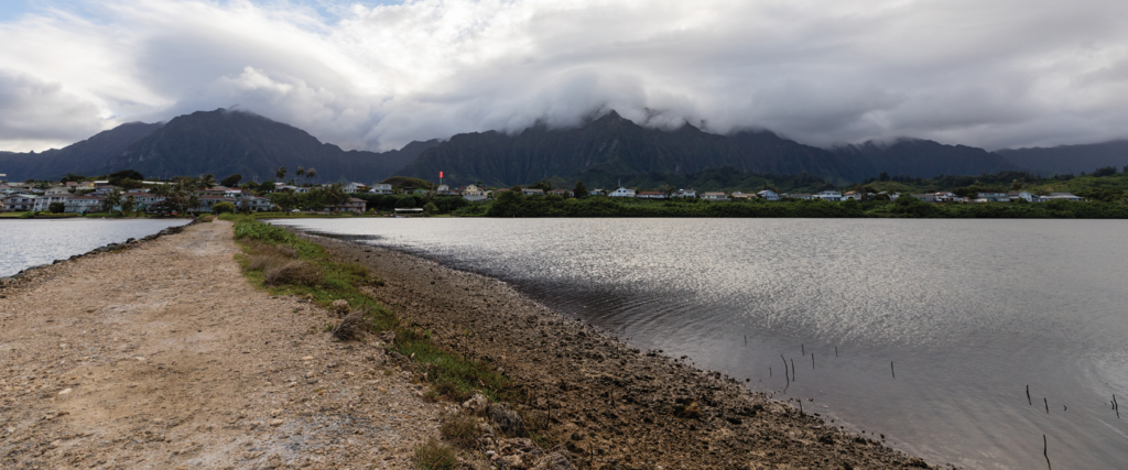
Through some initial seed funding from the University of Hawai‘i Sea Grant College Program in 2014, Glazer was able to build a prototype wireless sensor package for measuring dissolved oxygen in He‘eia Fishpond. Paepae o He‘eia is a private non-profit organization dedicated to caring for He‘eia Fishpond, an ancient Hawaiian fishpond located in Ko‘olaupoko, Oʻahu. Glazer, additional collaborators at UH, and managers at Paepae o He‘eia have worked together on various projects for more than a decade, establishing an interesting and productive blend of indigenous knowledge coupled to contemporary oceanographic techniques that helps to understand how the pond ecosystem functions today. The seed funding to show proof of concept for a low-cost wireless sensor of importance to traditional Hawaiian aquaculture enabled Glazer to collect enough preliminary data to submit a proposal to the National Science Foundation which was awarded in 2015. “We’ve been building functionality and robust networked sensor capabilities since then,” added Glazer.
Glazer claims that he knows just enough about building electronics and programming to be dangerous, so that’s why he hired Stanley Lio, a recent electrical engineering and computer science graduate from the University of Southern California. Together, Glazer and Lio have worked with a handful of undergraduate students in the Global Environmental Science undergraduate degree program, the staff at Paepae o He‘eia, and collaborators at the Hawai‘i Institute of Marine Biology to deploy and maintain up to 14 sensor packages measuring meteorological data, tides, water temperature, light extinction, salinity, dissolved oxygen, pH, chlorophyll and turbidity. All of the data are wirelessly transmitted back to shore using radio frequency, thus avoiding costly cellular or satellite data transmission charges. Real-time graphs and all the time-series datasets for every sensor package are freely available through Glazer’s website: http://grogdata.soest.hawaii.edu/project_info/
Recently, Glazer received additional funding from philanthropists Eric and Wendy Schmidt to continue this approach to democratizing access to oceanographic sensor technology.
“Fundamentally, access to low-cost electronics and open-source software now allows for a diversity of participants to design, build, deploy, maintain, and gather data from environmental sensors, but there still exists a need for developing a robust platform to increase numbers and types of sensors deployed while also maintaining highly rigorous data standards,” said Glazer. “A ‘mentored citizen science’ approach is at the heart of the work we’re trying to do in partnering with local non-profits, and we’re incredibly fortunate to have support from the Schmidt Family Foundation during a time when federal funding agency
budgets are particularly stressed.”
Robust, accurate and precise sensors that once required extensive electrical and computer engineering experience to build, test, package and deploy can now be rapidly prototyped, organized into DIY kits, assembled by non-experts, and incorporated into research monitoring programs and laboratory manipulative experiments. There are obvious advantages to the research community for accessing lower cost, more widely deployable observation platforms to better understand conditions in the environment—but the research community may be just the beginning.
Glazer envisions a day when site-specific tide gauges and other oceanographic data are as widespread for coastal communities as rooftop anemometers coupled to mobile phone apps are among weather enthusiasts.
“The National Weather Service only maintains about 12,000 meteorological stations nationwide, whereas Weather Underground crowd sources sensor data from over 250,000 personal weather stations globally to provide data redundancy, local microclimate information, and satisfaction for the curious weather observer who may want to know exactly how fast a gust of wind at their house was,” said Glazer. “Just three years ago it was cost prohibitive to dream of a similar platform for coastal oceanographic measurements, even for something relatively simple like water level. But now, thanks to emerging lower cost electronics and sensors, I think we can begin to really tackle the problem of an undersampled coastal marine environment.”